How to Visit Dettifoss from the West Side
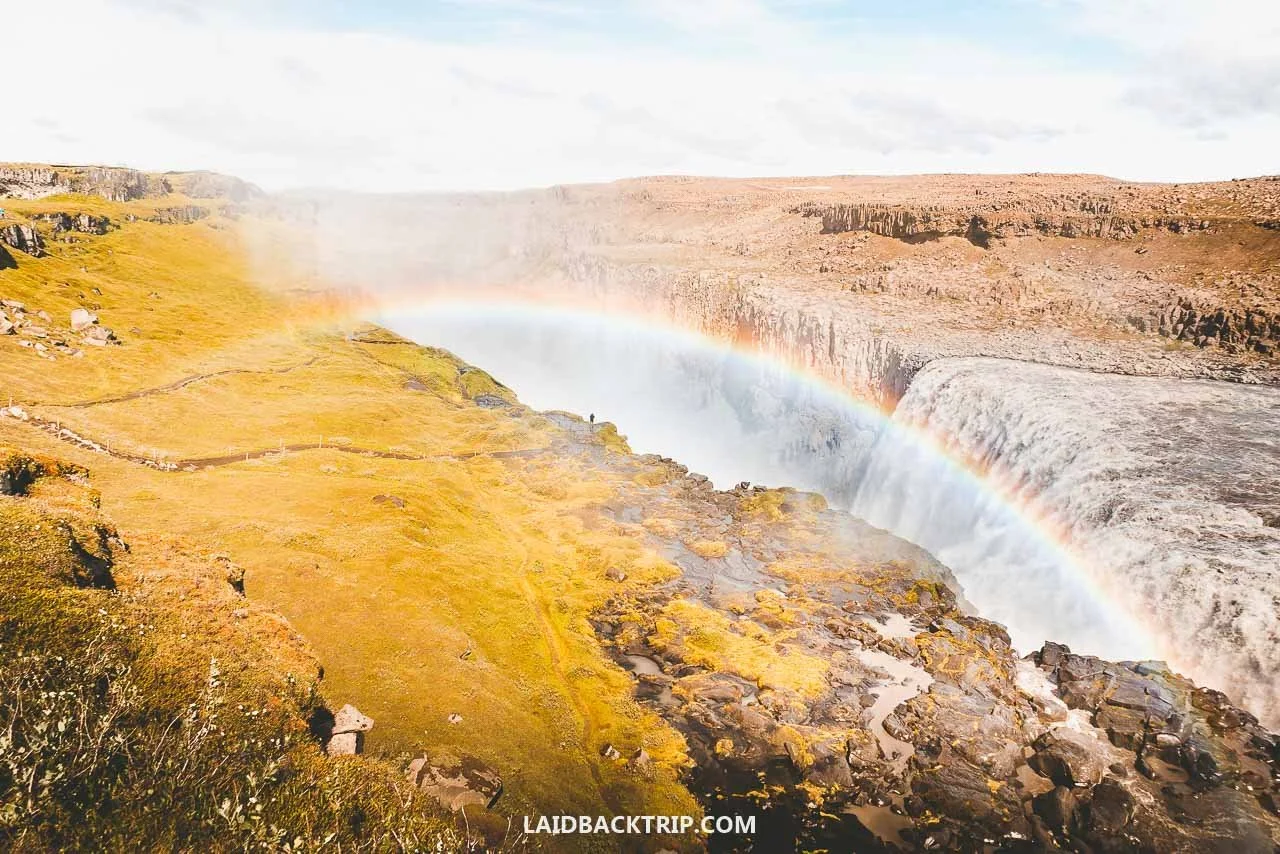
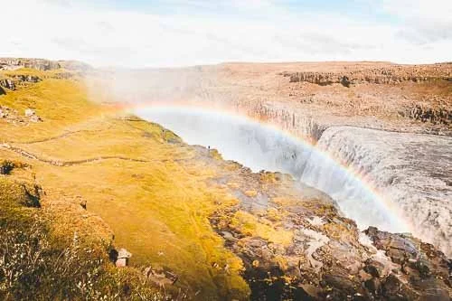
One of the classic views of Dettifoss, with a rainbow over Jökulsárgljúfur Canyon.
Of all the waterfalls we saw in Iceland, Dettifoss was easily the most powerful, and it was the main highlight of our trip around North Iceland.
Today, we finally reached North Iceland, and the very first attraction on our itinerary was, surprise, surprise, a waterfall. It wasn't just some random cascade without a name, though, but Dettifoss, one of the most powerful waterfalls in Europe. Normally, Lucie would say, another day in Iceland, another waterfall, but this time it was different. This was one of Iceland's most famous waterfalls and one of the must‑sees in the North Iceland region, and we were really excited to finally see it.
We had been on the road for five days already, traveling the Ring Road counterclockwise, which meant we had already seen the other big waterfalls in Iceland: Skógafoss, Gullfoss, and Seljalandsfoss, with Dettifoss being the final piece of the puzzle. Each of these waterfalls was spectacular and unique in its own way, and while we had seen plenty of photos of Dettifoss before, whether in the airport halls in Keflavík or online while planning the trip, we knew visiting in person would be totally different.
Dettifoss is located in Vatnajökull National Park, on the Jökulsá á Fjöllum River, which is fed by the Vatnajökull Glacier, the largest ice cap in Europe. We had already seen what this glacier is capable of when we hiked in Skaftafell, but that was on the South Coast, surrounded by its outlet glaciers.
Now we were in the north, standing in a barren, lunar‑like volcanic landscape, with the massive Jökulsárgljúfur canyon and a roaring glacial river. The fun part was that a short walk from Dettifoss was another waterfall called Selfoss, which at the time we didn't pay much attention to, only to find out how impressive it really was.
On paper, visiting Dettifoss looked as easy and straightforward as any of the waterfalls I already mentioned, but this time there was a small catch. Dettifoss can be viewed from both sides, each accessible by a different road, and by the time we reached the turnoff, we had to decide which one to take, since the waterfall sits about 20 kilometers north of Route 1. Another thing we needed to figure out was that Dettifoss is part of the Diamond Circle, the main scenic drive in North Iceland, so we had to plan how we'd fit the whole thing together. So this is how it went.
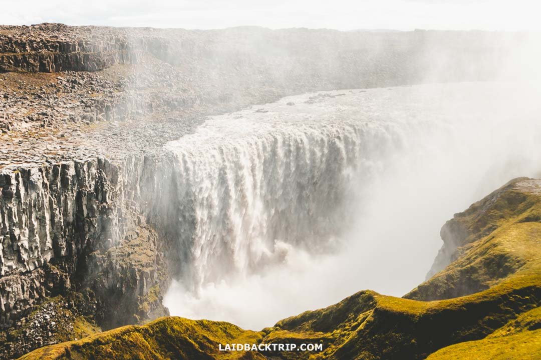
We ended up visiting Dettifoss from the west side simply because it was way more accessible from there.
Visiting Dettifoss: Iceland's Most Powerful Waterfall
After traveling for years, we sometimes need a good story to convince us to visit a place, but with Dettifoss, all we needed was hearing about the sheer force of water thundering into the canyon. It's hard to imagine a more impressive waterfall in Iceland, even with so many incredible ones around. And the thing about Iceland is that the competition never sleeps, just like what happened to Glymur, which used to be the highest waterfall in the country until Morsárfoss formed from a melting glacier and took the top spot.
Dettifoss Facts
Every visit to this waterfall, ours included, starts with some basic stats, because they're what make Dettifoss so famous. The waterfall is 100 meters wide, 44 meters high, and its average flow rate is roughly 200 m³ per second, with peak meltwater flow in summer reaching up to 500 m³ per second, which honestly was hard to imagine from the comfort of our home. And as you've guessed, it's really that last number that makes it so impressive.

Hearing that Dettifoss is one of the most powerful waterfalls in Europe is one thing, but seeing that power in person is something else entirely.
We knew Dettifoss is often regarded as the most powerful waterfall in Europe, but to us it didn't really matter. These were just numbers, and no matter how impressive they sounded, being there in person, watching the constant flow of the Jökulsá á Fjöllum River plunge off the volcanic cliff, accompanied by the thunderous sound and sheer amount of spray, was on another level.
Once we were standing on the edge of the canyon's lower trail overlooking the falls, we finally understood what those numbers meant. We were there at the end of June, so Dettifoss's flow rate was higher than the usual 200 m³ per second, but I really can't say by how much. Whether it was closer to the average or pushing toward its peak volume, the amount of water we saw rushing through this waterfall was unlike anything we had seen so far.
Visit Dettifoss from East or West Side?
After knowing the stats, we had to decide on the practical things, and the most important one was choosing whether we wanted to see Dettifoss from the east or west side. From what we gathered, the west side connects to the Ring Road via Road 862, while the east side is reached by Road 864. Each side offers different views and a slightly different experience.
We heard that the east side offers slightly better views, though that's definitely subjective because I think the west side is just as good. The fact is that it's less visited, which means smaller crowds and a quieter experience. The east viewpoint is also a few hundred meters closer to the waterfall, but we didn't mind a longer walk after spending the whole morning in the car. On the west side, Dettifoss is a 600‑meter walk, while the east parking lot is only about 300 meters away, but the difference felt negligible.
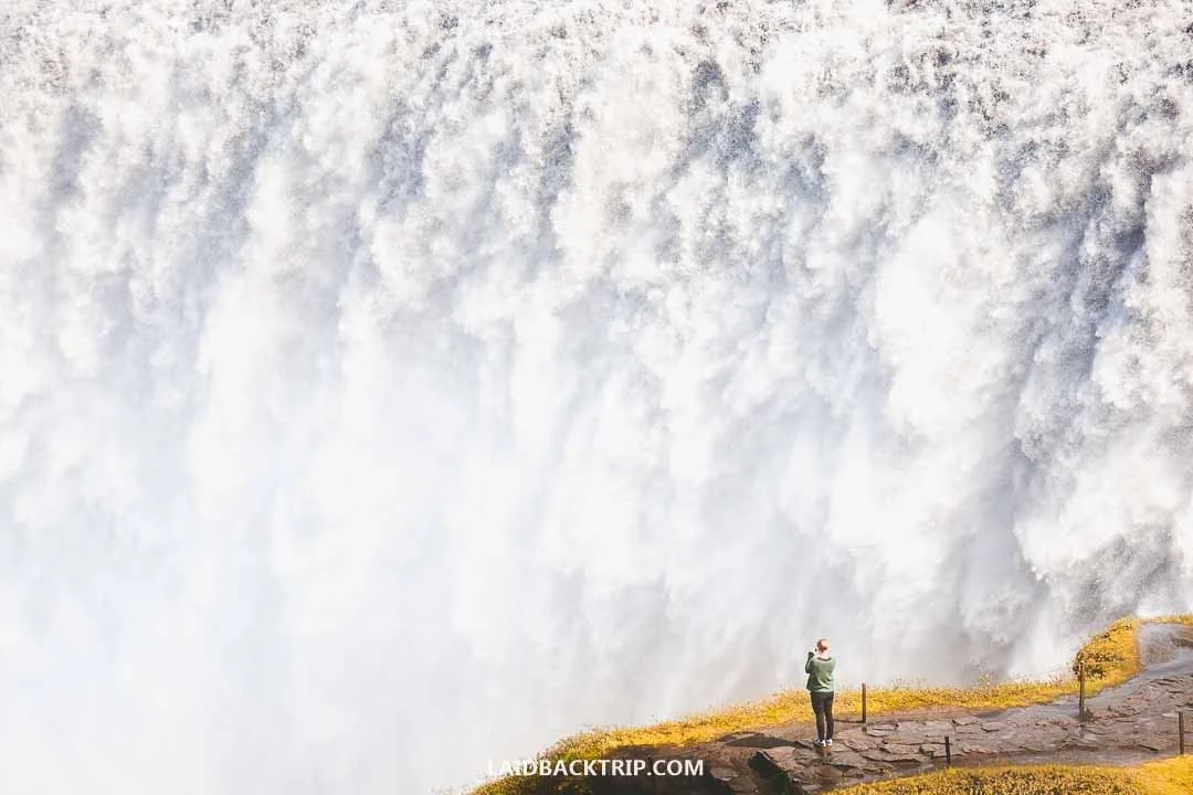
The views of Dettifoss from the west side were simply breathtaking.
The biggest difference was practical: the west road is paved, while the east road is gravel and often in poor condition. For us, this wasn't much of a debate because we had a small 2WD campervan, we were a bit short on time since we also wanted to explore Námafjall - Hverir, and most importantly, we had a whale watching tour booked in Húsavík for the evening. Driving Road 864 would simply take too long.
So we decided to keep things simple and visit the waterfall from the west side. As we approached the area, we found out Road 864 was closed anyway, so we couldn't see Dettifoss from the east side even if we had wanted to. And because the views from the west side were spectacular for us, we didn't feel the need to check the other side even if it had been open.
Thanks to the paved road, visiting the west side of Dettifoss makes sense for most travelers, as it's far more accessible and, from what we saw, definitely busier. And while we weren't on the east side, we had a feeling we could see the drop from a better angle because the waterfall was facing toward us. To be fair, we couldn't see the bottom of the gorge most of the time, which would be easier from the east side.
The only downside was that, because all the water was falling toward us, standing at the west side's lower viewpoint meant enjoying plenty of mist and spray (like we also did at Kvernufoss or Dynjandi). Since we visited during a sunny part of the day, we didn't mind it at all. It even felt like standing on the opposite side would've kept us a bit more protected from the spray. Still, visiting Iceland's waterfalls wouldn't be complete without feeling the mist.
Getting to Dettifoss by Road 862
Driving is the easiest way to get to Dettifoss, and as we've already mentioned, it's possible to visit the waterfall from two sides. That means two separate roads lead to the viewing platforms on each side of the canyon, and we had to decide which one we'd take.
Since we visited Dettifoss on our own, we traveled there by car. And because we had a small 2WD campervan, we chose Road 862 instead of 864. We started our day in Borgarfjörður eystri, at the campground in Bakkagerði, which meant we were looking at a 230‑kilometer drive.
First we had to travel back to Egilsstaðir. We didn't take the shortcut via Roads 944 and 925, even though it would've saved about 40 kilometers, simply because it was unpaved and most likely wouldn't save any time. From Egilsstaðir, it was 160 kilometers to Dettifoss by following the Ring Road.
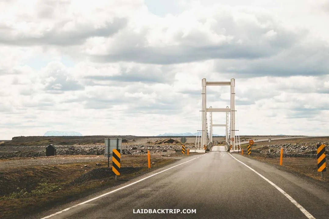
Even just driving to Dettifoss through that barren volcanic landscape felt like we were on another planet.
This time we didn't take any detours, just made a few stops to take photos and enjoy the views. Coming from the East Fjords, this whole stretch felt completely different. It was desolate, barren, and clearly volcanic. Interestingly, it was very different from Sólheimasandur and Eldhraun we explored earlier, so the next time we saw something similar was on Reykjanes at the end of the trip.
About 24 kilometers before Dettifoss, we left the Ring Road and turned right onto Road 862. We stayed on it for more than 20 kilometers, then turned right onto Road 886, which brought us to Dettifoss West Parking in about three kilometers.
As I said, even if both roads had been open, we would've most likely still chosen Road 862 simply because it was paved all the way from Road 1 to the large West Dettifoss parking lot. When we were there, the stretch looked almost brand new, and beyond the waterfall there was ongoing construction to pave the road all the way to Road 85.
We visited at the turn of June and July, which meant the road was clear of snow and very easy to drive. We read that this road isn't maintained from December to April, which makes visiting Dettifoss during that time not a great idea, even with a proper 4x4. Because we were there in summer, we didn't have to worry about that, though each year is different and it can snow here even in May or September (and for example, we could see a lot of snow on the way to Seyðisfjörður).
Since the stretch beyond Dettifoss leading to Ásbyrgi was unpaved and we had a whale watching trip booked, we took a roundabout route: first visiting Húsavík, then Ásbyrgi Canyon, and finally returning to Mývatn (to enjoy the nature baths). But if we arrived now, with the whole Road 862 paved, we'd definitely continue north to Ásbyrgi, which makes the Diamond Circle road trip flow much better.
After Dettifoss, we traveled to Húsavík, about 100 kilometers away (it would've been just 90 had we continued via the north route). Akureyri was eventually 130 kilometers from Dettifoss, with great stops along the way like the whole Mývatn area and Goðafoss.
Getting to Dettifoss by Road 864
We let go of the idea of reaching Dettifoss from the east side via Road 864 for all the practical reasons I mentioned earlier. The road was gravel, rough, and not ideal for a small 2WD campervan, and it didn't match our schedule with the whale watching cruise coming up. We actually did consider it for a moment, because it sounded more adventurous, but that thought disappeared instantly when we found out Road 864 was still closed, even at the end of June.
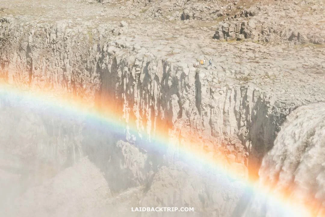
Even though Road 862 was closed, there were still a few people over on Dettifoss's east side.
It looked like winter had lingered longer than usual, leaving the dirt road in worse shape than expected. That made the decision simple, since Road 862 was the only option left. And honestly, it ended up fitting our plans better anyway.
Getting to Dettifoss Without a Car
There's no bus service to Dettifoss, so unless you're up for hitchhiking from Reykjahlíð 50 kilometers away, the only real option is joining a tour. Most day tours leave from Akureyri or Mývatn and cover the usual Diamond Circle highlights. If we'd been visiting Dettifoss without a car, we'd probably have taken a closer look at this option.
Dettifoss West Parking
About 25 kilometers before we reached the Mývatn area, we turned right onto Road 862 and stayed on it for about 21 kilometers. Then we turned right onto Dettifoss Road, which took us to the West Dettifoss Parking. When we arrived, we realized how popular Dettifoss really was, because the parking lot was huge (like at Geysir or Blue Lagoon), especially compared to the tiny lot at the Hafnarhólmi puffin colony and other spots in Borgarfjörður eystri we visited the day before.
We found a spot right away, though judging by the number of cars, it looked like we hadn't arrived on the busiest day. Parking at Dettifoss, on both the west and east sides, was free, and unlike so many places that have started charging fees, this one still hasn't. Just don't forget that overnight parking isn't allowed at Dettifoss.
No Entry Fee to Dettifoss
When we were there, Dettifoss had no entry fee. And unlike places like Reykjadalur Hot Springs or Þingvellir, which introduced parking fees, this one still hasn't, so it really felt like we could see the waterfall for free.
To be honest, Dettifoss was one of the places where we probably wouldn't mind paying a small fee, especially when compared to some smaller sites that now charge for parking. But being able to enjoy all this beauty without buying any tickets was pretty awesome. Hopefully, Dettifoss won't follow the trend, and things will stay the same in the future.
Dettifoss Trail
We decided to visit both waterfalls, first Dettifoss and then Selfoss, since we had time and wanted to make the most of this detour. The first view of Dettifoss came after 600 meters of walking, but the full trail to the farther viewpoint was about 1.1 kilometers one way. Then there was a short 400‑meter loop that took us to the lower viewing area right next to the edge of Dettifoss. After that, we continued to Selfoss, which was another 600 meters, and then walked a kilometer back to the parking lot.
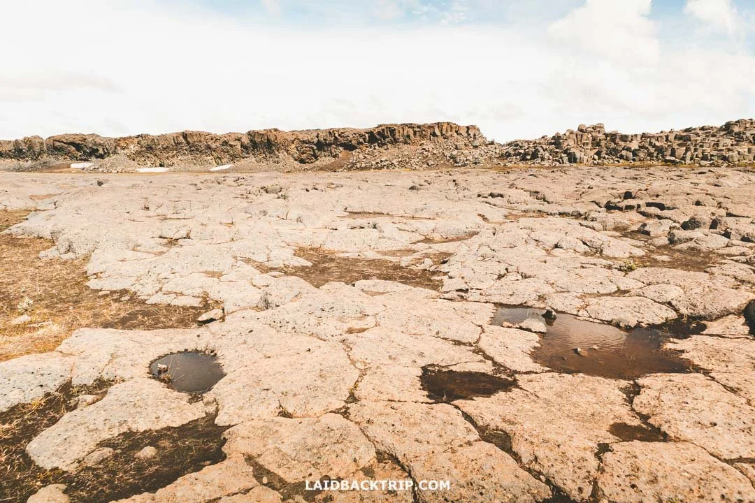
The whole walk from the west parking lot to Dettifoss led us through this barren volcanic landscape.
All in all, we walked just under four kilometers to see both waterfalls. Put that way, it might sound complicated, but it really wasn't. The trail basically looked like a big T, with Dettifoss viewpoints on the left, the middle (plus the extra loop for the lower viewpoint), and Selfoss on the right. It was an easy hike with almost no elevation gain, so we moved pretty fast.
For the first few hundred meters, Dettifoss and Selfoss shared the same trail, so we just followed our nose. The path was easy, mostly flat, fairly wide, and almost dry, with barely any rocks. After about 400 meters, there was the first turnoff for Selfoss, but we ignored it and continued straight to the left. Later, we used that path on the way back from Selfoss.
The whole time we were surrounded by a lunar‑like landscape. The gray volcanic plain was a striking contrast to the scenery we'd seen in the previous days, especially around the waterfalls like Mögárfoss or Gufufoss.
In less than two hundred meters, we spotted Selfoss in the distance through a gap in the rock, but it was still far away, so I snapped a few photos with my telephoto lens and kept walking. We expected to hear the thundering roar of the waterfall from a distance, but the rock walls absorbed the sound, and we didn't hear anything until we reached the edge of the canyon. And we still couldn't see Dettifoss because it was hiding behind a rocky barrier, but that changed within seconds.
First Viewing Area
As soon as we reached the main viewpoint, we could finally spot Dettifoss for the first time. We could finally hear it too. The first impression was overwhelming. The waterfall looked incredibly powerful. From this point, we also saw a beautiful rainbow stretching over Jökulsárgljúfur, which I guess is a pretty common sight here on sunny days.
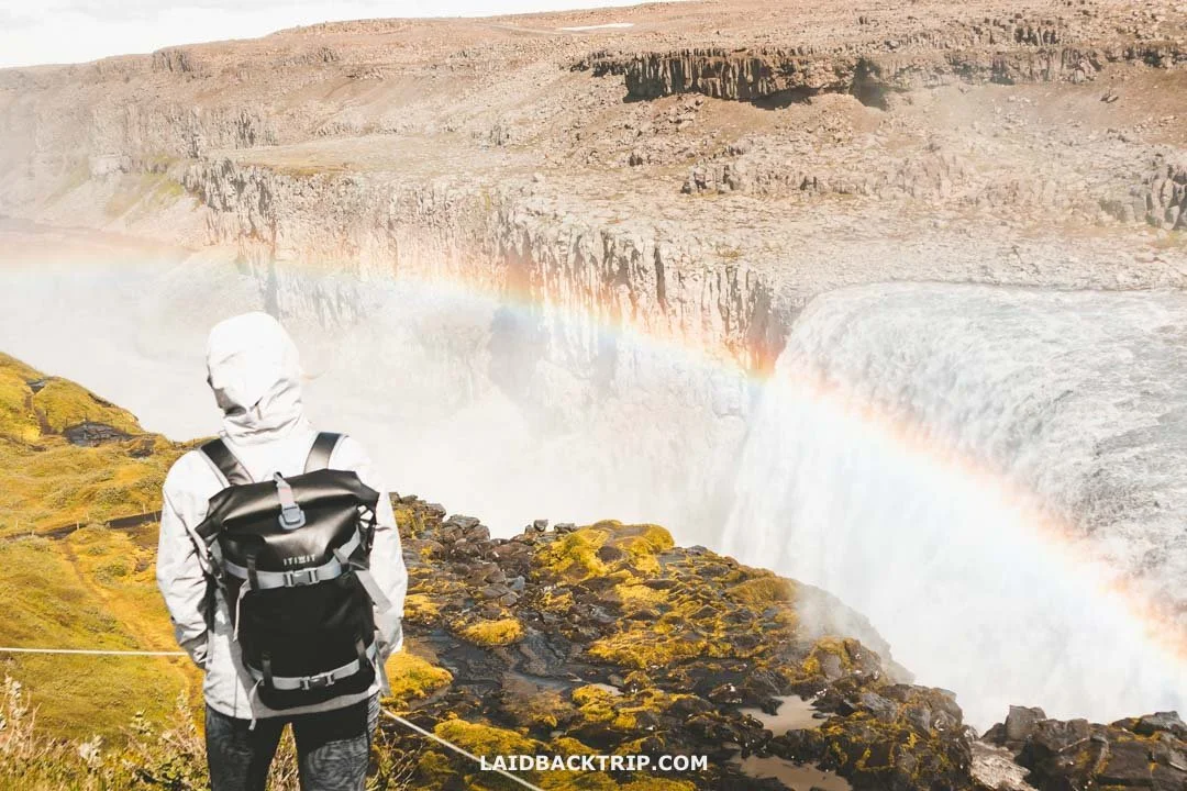
Even from up here, we could feel just how powerful Dettifoss was.
Another interesting detail was that on this side of the canyon we could see quite a lot of green. Up to that moment, everything around us had been gray and volcanic, even the river and Dettifoss itself, but this part of the canyon was constantly sprayed by the waterfall, so the vegetation had a chance to survive.
Dettifoss Lower Trail
From here, we could've done a short loop hike that brought us right up close to Dettifoss. Before we arrived, we were really eager to get as close as possible, but when a small group returning from the trail passed us, drenched to the bone, we started having second thoughts.
Still, the weather was great, and our curiosity won. The trail was well‑marked and clearly visible from above, as were a few more poor souls down below getting blasted by the spray where we were supposed to walk. We just needed a moment before we made that first step.
We kept our rain jackets on (it was warm enough that we ditched the ponchos ) and took the first right, descending toward the waterfall. The closer we got, the muddier the trail became, and by the time we were almost at the edge, it had turned into big puddles. We were nearly there, and the spray grew stronger with every step. Then we reached the canyon's edge.
The power was unreal, and the view was almost dizzying. Standing at the upper viewpoint minutes earlier, we thought we'd already seen the true force of Dettifoss. But not really. Not until we got here. Being face to face with such a raging beast was a completely different experience. It's one of those places you have to visit yourself to understand. I had my camera in hand, but using it was impossible. The spray covered the lens the moment I took off the cap. I didn't mind. This was one of those moments where you just put the camera away and enjoy it.
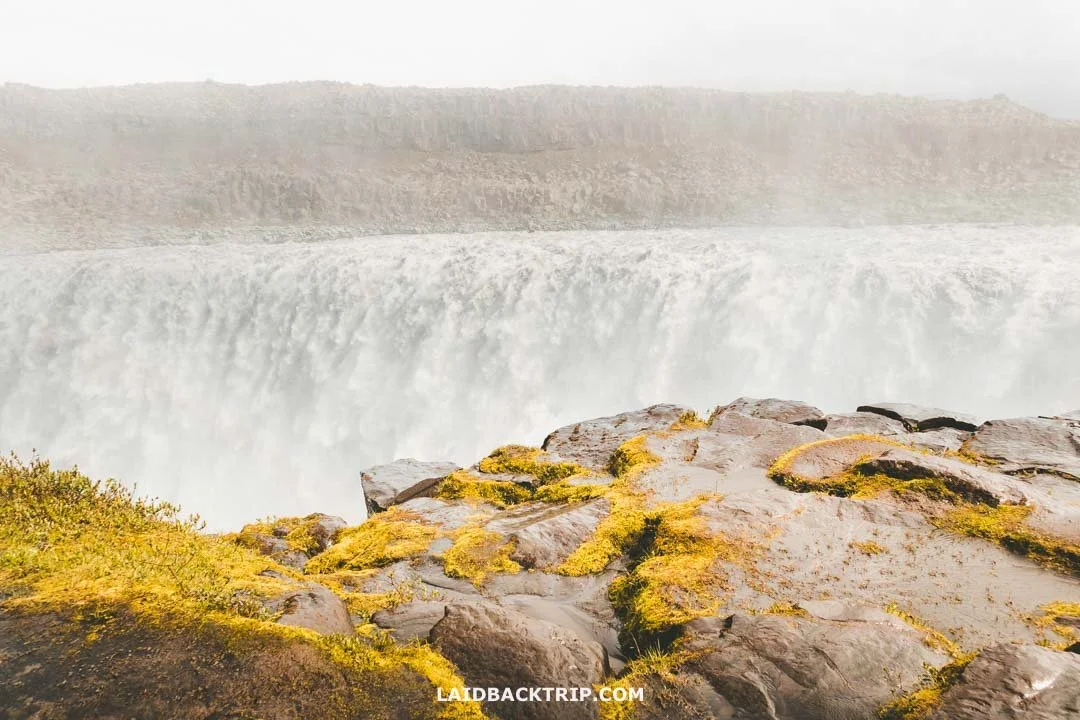
This was as close as we could get to Dettifoss.
Staying Safe at Dettifoss
From here, we followed the path along the canyon's edge. This lower part of the trail was more rocky and therefore more slippery. And if there was one place I really didn't want to slip, it was this one. And judging by the look on her face, Lucie didn't either. It didn't feel tricky or dangerous, but things can happen, right? And Dettifoss, with its raging water and deep gorge, was almost within reach.
World Nomads provides travel insurance for travelers to cover their trip essentials, including sports and adventure activities.
SafetyWing is affordable travel insurance for backpackers, long-term travelers, and digital nomads.
Interestingly, I felt the same way earlier on this trip when we did the cliff walk on Dyrhólaey or when we hiked along the Látrabjarg cliffs, but that's a different story. When we reached the furthest point, we looped back to where we started.
It was a great little loop and definitely worth doing. For this whole section, wearing some rain gear was essential so we didn't get drenched, and our trusty hiking boots came in handy not just to keep our feet dry, but also to prevent slipping.
Update 09/2026: The lower trail at Dettifoss remains closed following a recent landslide.
Second Viewing Area
Now we headed north along the canyon to the other main viewpoint. This part of the trail was easier, clearly marked, and almost completely free of spray. The viewing area was about 500 meters further down the valley, and we finally got a chance to dry our clothes a bit in the sun. After a few minutes of walking, we reached the platform, and from here we got yet another incredible view of Dettifoss.
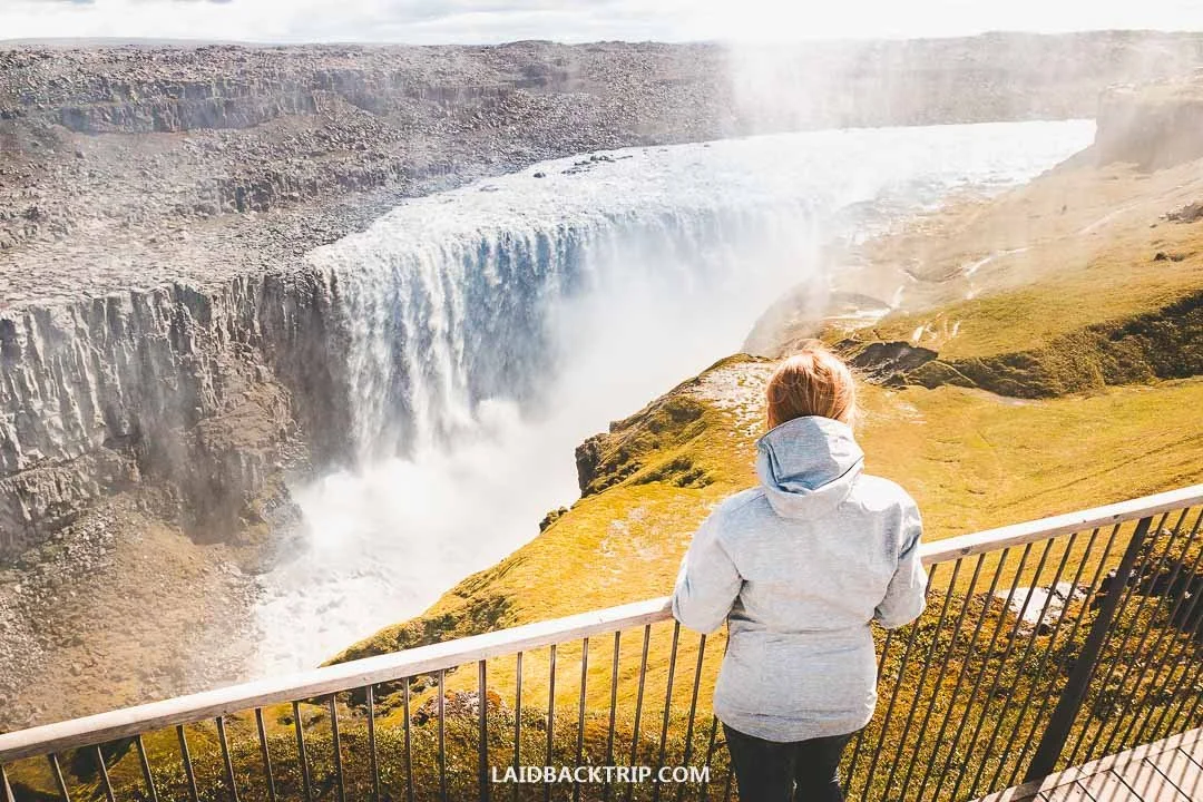
From the second observation area, we could see pretty much all of Dettifoss.
Up to this point, we couldn't see the bottom of Jökulsárgljúfur, but from here we could finally spot the dramatic results of what happens when that much water drops from 44 meters. Again, the whole scene was breathtaking. The platform had two lookouts, each offering a slightly different angle of Dettifoss. After we'd had enough of the views, we headed back.
We could either take an inland trail through the barren landscape with no views or retrace our steps and have Dettifoss in front of us the whole time, so that was an easy choice. After another ten minutes of walking, we reached the spot where we'd first seen the waterfall. Now there was one last thing left to do, and that was to see Selfoss.
Selfoss Trail
From here, Selfoss was about 600 meters further upstream. As I said, we'd already seen it from a distance, but that really wasn't the same. The trail was well marked, a few eroded sections were roped off, but we could still walk very close to the cliff's edge.
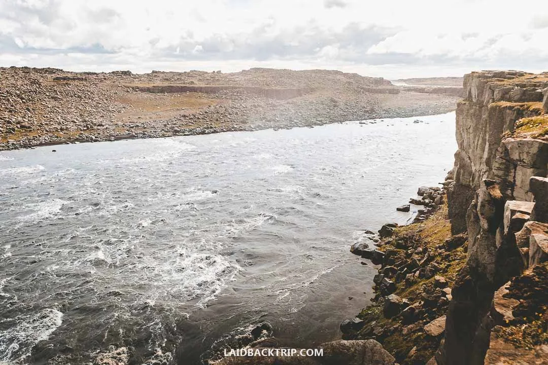
From Dettifoss we headed toward Selfoss, with the Jökulsá á Fjöllum River on our left the whole way.
I have to admit that while here Jökulsá á Fjöllum looked almost timid compared to what we'd just seen at Dettifoss, we still didn't want to end up in the river. The scary part was that even though it looked like we were walking on solid, safe rock, we could see collapsed basalt columns lying in the gorge (we saw them already at Hengifoss or Reynisfjara). That was enough evidence for us to stay a bit farther from the edge.
Again, there was basically no elevation gain on this trail, so it was as easy as it gets. Selfoss is only 11 meters high, but with its horseshoe shape, it's pretty wide, though that depends on how much water is flowing. Along the way, we got some great views of the waterfall and realized the angles were much tighter, almost forming a V‑shape. It didn't matter, though, because the views were spectacular.

Selfoss was as dramatic as the famous Dettifoss.
From up here, we couldn't miss the brownish‑grey color of the river, all thanks to the glacial silt washed down from Vatnajökull. It looked nothing like the bright blue water at Brúarfoss we'd visited earlier, which, coincidently, had a horseshoe shape too.
The trail ended at a series of smaller streams cutting through rocky channels. Selfoss was still a few dozen meters away, but each stream we crossed was trickier than the last, and it quickly became clear that the whole area near the waterfall was flooded.
I joked that we were literally walking through a riverbed, and I wasn't wrong. Later, I saw photos of this area completely dried up (probably in autumn), covered in snow (winter), and totally flooded (spring and early summer). Either way, the result for us was that we had to turn back and couldn't get as close to the waterfall as we imagined.
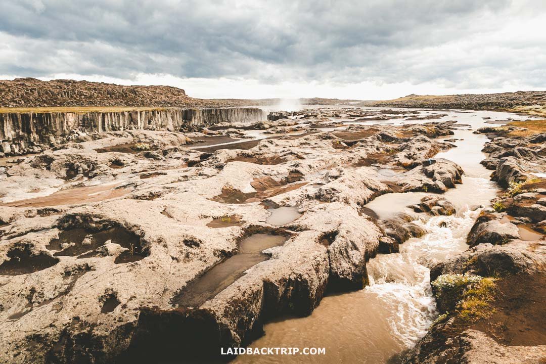
This was as far as we could go, so we couldn't get a close‑up view of Selfoss.
Earlier, I talked about the amount of water flowing through Dettifoss each second, with a big difference between peak melt flow and normal flow. And now I had my answer: it was probably somewhere in between. The funny part is that Selfoss is completely overshadowed by Dettifoss, but for us, it was one of the most stunning waterfalls we saw in Iceland.
The last thing left was to head back. We had about a kilometer of walking ahead of us, and since we were returning to the parking lot, we took the left at the first fork to save a bit of distance and skip the main Dettifoss viewpoint.
When to Visit Dettifoss
We visited Dettifoss in June, at the start of the Icelandic summer. And we really lucked out with the weather, considering where we were. The morning in the East Fjords was fairly cloudy, and the whole drive toward the waterfall wasn't much different, but when we arrived at Dettifoss, the sun finally came out. The clouds didn't disappear completely, but for a good part of the visit we could enjoy the warmth of the sunshine, whatever that meant in Iceland.
We were still in North Iceland, though, so we kept our rain jackets on. First, it wasn't completely windless (although compared to the Westfjords, it almost felt like it was), so it wasn't as warm as it might look in the photos. And second, we wanted to protect ourselves from the waterfall's spray.
I can imagine that visiting Dettifoss on a rainy day wouldn't be a dealbreaker the way it might be for a mountain hike, simply because waterfalls are spectacular even in bad weather. I just doubt we'd stay as long as we did on a sunny day.
Dettifoss was quite powerful at the turn of spring and summer, but as we'd already seen at Jökulsárlón, it looked like we'd missed the absolute peak flow of Jökulsá á Fjöllum. To be fair, Dettifoss is one of those places where it doesn't matter that much, simply because there's a huge amount of water all year round.
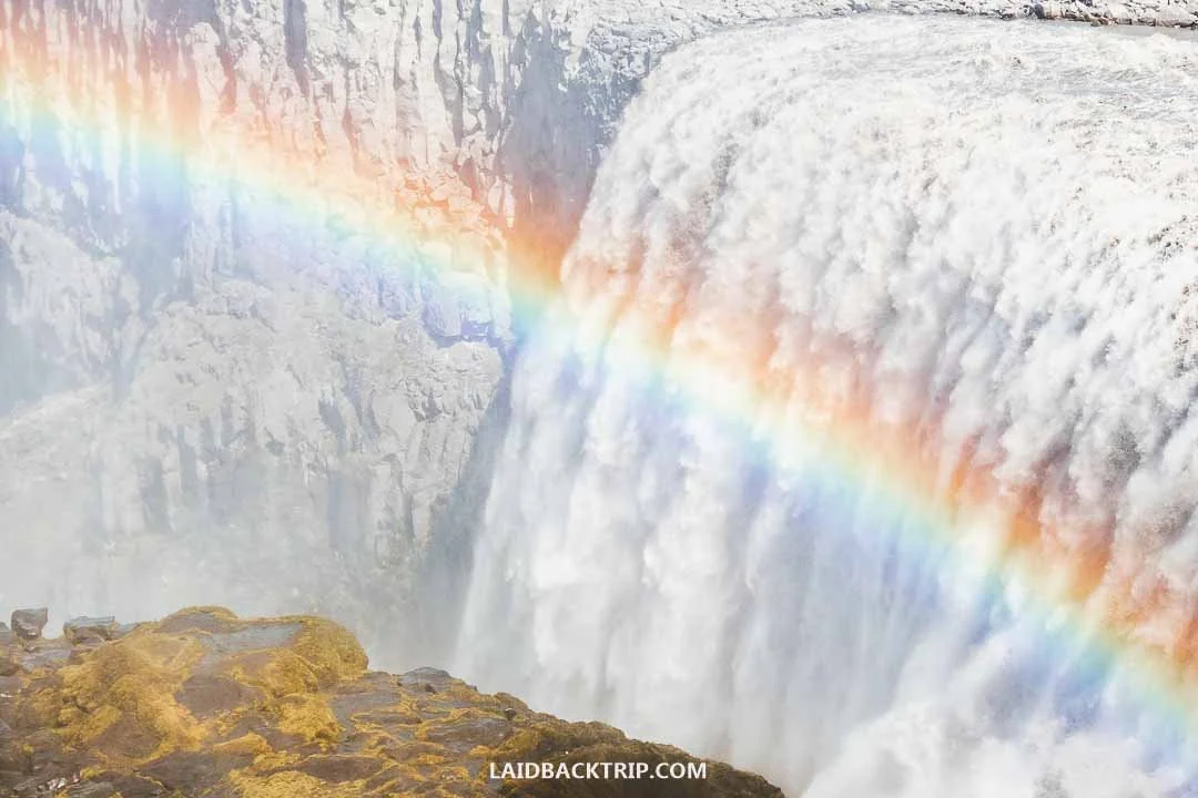
Dettifoss was very powerful in June, and even better, we visited on a beautiful day.
Summer brings the biggest crowds to Dettifoss, but we arrived on a fairly quiet day without any big tour buses. Even though we got there around midday, the area wasn't packed, which was great. And because we walked almost four kilometers around the viewpoints, the crowd had plenty of space to spread out, making the whole experience very enjoyable. It was nothing like places such as Kirkjufellsfoss, where the waterfall sits right next to the road.
We were glad we could see Dettifoss in summer, because it really is the best time to visit. And also because we'd like to come back to Iceland in winter someday, so we wouldn't feel the urge to visit Dettifoss during that season. The thing is that Road 862 is often covered in ice and snow and isn't maintained between December and April, while Road 864 is simply closed.
It's not impossible to visit Dettifoss in winter, but besides the difficult driving conditions, the trail itself would be snowy and icy. And not to mention the limited daylight, which would make timing the whole trip much more challenging. Seeing the waterfall in the dark wouldn't be much fun.
How Much Time to Spend at Dettifoss
The whole visit to Dettifoss took us under two hours, including the walk to Selfoss and back. We'd originally set aside an hour for the waterfall, so we ended up spending more time than planned, which left us with a bit less time later in the day, but we didn't mind. We visited on a fairly nice day, so we took our time and enjoyed the views longer than we would have if it had been raining or really cold.
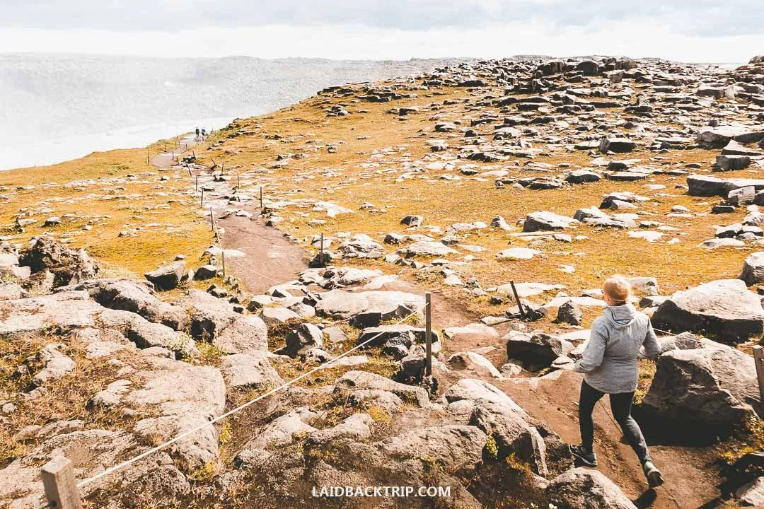
All the trails in the Dettifoss area were clearly marked and easy to follow.
Because Dettifoss was a detour and not just a quick stop on the Ring Road like Jökulsárlón Glacier Lagoon, we also spent at least another forty minutes driving there and back. Had we continued toward Road 85 as part of the full Diamond Circle loop, we wouldn't have counted it as a detour at all, simply because we wouldn't have needed to retrace our steps.
Where to Stay near Dettifoss
After we were done here, we continued to Víti Crater and the Hverir Geothermal Area, and then went for the whale‑watching trip. Because we still had plenty of time left in the day, we didn't put any thought into finding accommodation in this area. Dettifoss is located in the middle of nowhere, so there are no campgrounds or hotels right at the waterfall.
Since we were camping in Iceland, the nearest campgrounds we would've considered were Vesturdalur on Road 862 or Grímsstaðir on Road 864. Both looked pretty basic, but they were only a short drive from the waterfall.
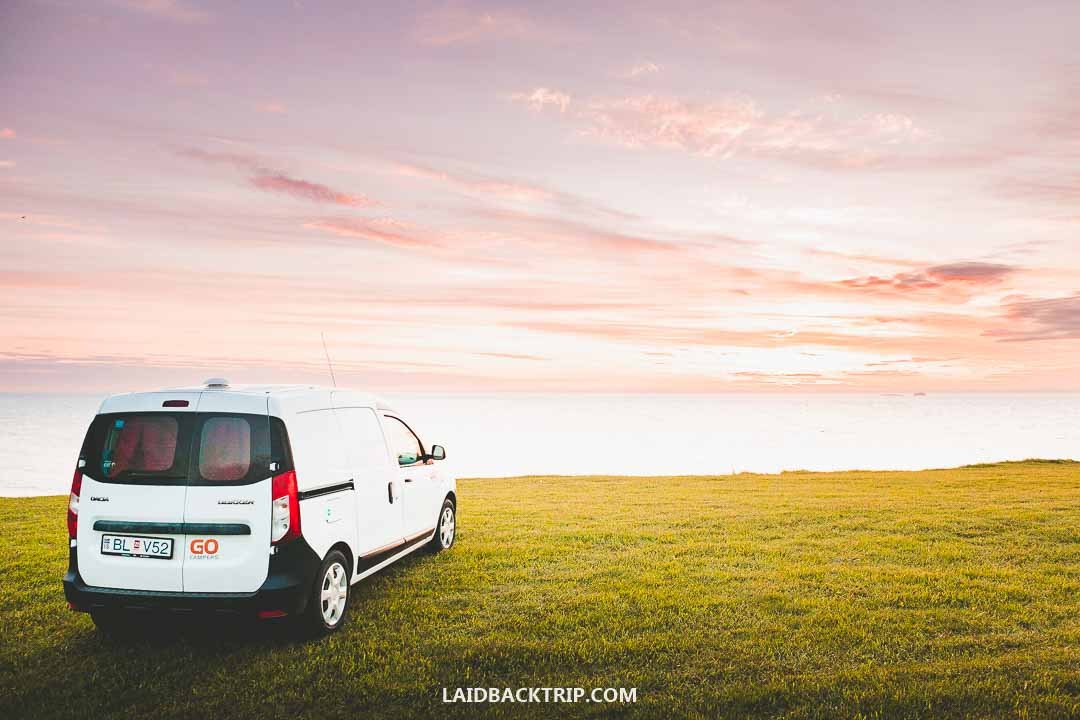
After Dettifoss, we continued exploring North Iceland and eventually stayed at a small campground on the northern coast.
For guesthouses and hotels, the closest options were Grímstunga on Road 864 south of the waterfall and Skúlagarður Country Hotel on Road 85 to the north. Another option would've been driving to nearby Mývatn, a popular tourist area with plenty of hotels like Sel Hotel Mývatn, or to Húsavík, where we briefly thought about staying but eventually decided to camp at Camping 66.12 NORTH, about 70 kilometers away when traveling north via Ásbyrgi, which also has a campground.
Travel Resources
Here you can find links to all the travel resources we use and which you might find helpful when planning your next holiday.
Accommodation: When looking for accommodation, we usually search hotels via Booking.com or Hostelworld.
Tours: Although we love to travel independently, some places are better to visit with a guided tour.
We prefer GetYourGuide for its easy-to-use interface and solid reputation. Another great alternative is Viator.
Rental Cars: When going on a road trip, we always use Rentalcars.com, a reliable site for booking a rental car in advance.
Flight Tickets: When looking for flight tickets, you can search Skyscanner to find the best price.
Travel Insurance: World Nomads and SafetyWing cover against risks of travel.
Visit Hverfjall in North Iceland with our guide, including how to reach the crater, a full description of the hiking trail around its rim, what to expect, and the best times to visit for ideal conditions.